Canada

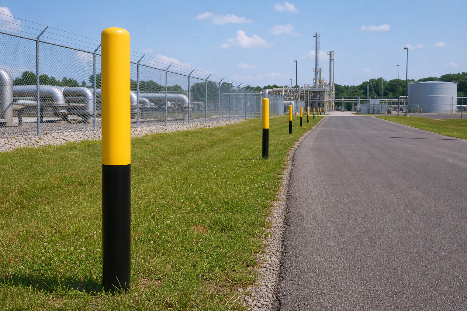
Underground utility markers identify the presence or approximate route of buried cables, pipelines, and other utilities. They do not establish the exact line location or burial depth, so they must not replace an 811 utility locate before excavation. Choose the system by utility type, message, viewing conditions, environmental exposure, and whether crews need a visible warning, a detectable signal, or both.
What underground utility markers are designed to communicate
Underground utility markers identify buried electrical cables, gas lines, water mains, sewer lines, telecommunications routes, and pipelines. A marker may communicate the utility category, a warning, the operator’s name, an emergency telephone number, or the approximate route.
Permanent signs and posts give workers, contractors, landowners, and emergency personnel a visible indication that a buried utility is nearby. PHMSA describes pipeline markers at prominent route points, including road, highway, railway, and waterway crossings. Pipeline route markers provide route awareness without serving as a precise survey reference.
A complete system may combine surface signs or posts with detectable warning tape, tracer wire, electronic markers, route records, and temporary field markings. The right combination depends on the utility owner, installation method, site environment, and future maintenance needs. See this overview of underground marker systems for more context.
What underground utility markers cannot prove
An underground utility marker cannot prove the exact horizontal location, burial depth, or safe digging boundary of a buried line. It is a warning and route-awareness device, not permission to excavate.
PHMSA states that pipeline markers show only the general location or right-of-way, not the precise location or depth of burial. Before excavation, do not rely solely on a sign, post, paint mark, flag, map, or electronic marker. Contact 811 in the United States, wait for the required utility responses and markings, and follow the applicable safe-excavation process. PHMSA’s excavation-damage guidance explains this limitation.
There is no universal distance that is safe to dig from a surface marker. Clearance, tolerance zones, hand-excavation methods, and other controls vary by jurisdiction, utility owner, project type, and site conditions. Treat the marker as one warning cue, not as a measurement.
Underground utility marker systems compared

Each marker type solves a different identification problem. A visible sign helps people recognize a route, while a detectable or electronic component supports locating work. Many facilities need more than one layer.
| System | Primary job | Signal | Permanence | Useful setting | Key limitation |
|---|---|---|---|---|---|
| Surface signs and posts | Warn that a buried utility is nearby | Visible text, color, symbols, and contact details | Usually permanent | Rights-of-way, crossings, boundaries, and access points | Shows an approximate route, not exact coordinates or depth |
| Detectable warning tape | Provide a subsurface warning near a buried service | Visible tape and a detectable element, depending on product | Installed with the utility | New trenching and utility installation | Must suit the utility and construction method |
| Tracer wire | Support electronic tracing of nonmetallic utilities | Conductive wire accessed by locating equipment | Installed with the utility | Nonmetallic pipe or conduit routes | Requires suitable access, continuity, equipment, and planning |
| Electronic markers | Provide detectable references at selected locations | Electronic response to compatible equipment | Usually lasting | Crossings, bends, tees, and access features | Does not establish the entire route, depth, or clearance |
| Temporary paint and flags | Communicate an active locate or proposed excavation | Temporary colors, symbols, and ground markings | Short-term | Construction and maintenance work | Can fade, move, or be covered |
| Locator workflow | Find and mark utilities using approved methods and records | Equipment readings, records, surface marks, and verification | Temporary markings support current work | Before excavation or route investigation | Still requires local safe-excavation practices |
Permanent markers, temporary markings, and locator work
A permanent underground utility marker is an installed sign, post, or other lasting identification feature. A temporary marking communicates information for current excavation, construction, maintenance, or survey work.
Permanent pipeline markers may identify the pipeline, operator, and emergency contact information. PHMSA explains that these markers indicate the presence of, but not necessarily the exact location of, an underground pipeline. Pipeline marker information should therefore be treated as route and emergency guidance.
The person who marks underground utilities is commonly called a utility locator or locating technician. That role differs from the manufacturer or supplier of a warning sign. A sign supplier does not automatically provide locating, surveying, 811 coordination, or installation services.
What do utility marking colors mean?
In common U.S. temporary marking conventions, red generally identifies electric power, yellow identifies gas or petroleum products, orange identifies communications, blue identifies potable water, green identifies sewer or drain lines, purple identifies reclaimed water or irrigation, white identifies proposed excavation, and pink identifies temporary survey markings.
Use those colors as orientation, not proof. The applicable convention depends on the marking system, jurisdiction, utility owner, project specification, and whether the marking is temporary or permanent. Read the legend and wording, confirm the utility owner, and follow the local One-Call response instead of identifying a line by color alone.
Match the marker message to the utility
The message should tell the reader what is nearby and what caution is relevant. A generic warning may be useful, but it does not provide the same information as a utility-specific message naming the service or operator.
Buried cable and telecommunications routes
A buried cable warning sign should identify underground cables and be positioned where maintenance teams, contractors, or excavators will see it before entering the route area. If several systems share a corridor, record the owner or service category so the warning remains clear.
Gas and petroleum pipelines
Gas and petroleum route markers need clear warning language and, where required, operator identification and an emergency contact number. PHMSA notes that above-ground markers identify the approximate location of buried petroleum, natural gas, chemical, ammonia, and carbon dioxide pipelines. For above-ground facility piping, use the applicable piping-identification approach instead of treating an underground route sign as a pipe marker. Gas pipe marker guidance covers that distinction.
Water, sewer, and mixed corridors
Water and sewer markers should distinguish potable water, process water, stormwater, wastewater, or reclaimed water where those differences matter. In a mixed corridor, use separate records and messages for each utility instead of relying on one general sign.
A visible warning option for buried cable routes
VisionMarker’s CAUTION UNDERGROUND CABLES sign is a visible warning option available in aluminum, rigid PVC, and vinyl. Listed sizes range from 2.75 x 4 inches through 24 x 36 inches, and the listing states that it meets ANSI Z535, OSHA, and OSHA 1910.1200(c).
A second CAUTION UNDERGROUND CABLES option offers rigid PVC and vinyl, including a listed 3.18 x 5.34 inch size and formats up to 24 x 36 inches. Compare the two listings by material, dimensions, message, mounting location, and quantity. Neither product establishes a locating service, exact route, burial depth, or permission to excavate.
Choose materials, size, and mounting for the site

Material selection should follow the installation environment. Review sunlight, rain, moisture, chemicals, abrasion, impact, vegetation, vehicles, vandalism, temperature changes, and cleaning processes before ordering.
- Outdoor exposure: Select construction intended for the route’s UV, moisture, and weather conditions.
- Viewing distance: Use larger signs and lettering when people must read them from vehicles or across a work area.
- Mounting surface: Choose a post, fence, wall, cabinet, bollard, or other suitable support that faces the approach path.
- Lighting and sightlines: Check glare, shadows, vegetation, stored materials, snow, and equipment from both directions.
- Physical abuse: Near traffic or public access, consider impact, tampering, and movement of posts or panels.
Self-adhesive markers can identify exposed pipe sections or access points within a wider system, but they do not substitute for buried-route markers or a locate. Compare self-adhesive pipe markers with the exposed surface and environmental requirements.
A specification workflow for ordering or planning

- Identify the utility and owner. Record the service and responsible owner or emergency contact.
- Define the warning message. State what the reader must recognize, such as underground cables, natural gas pipeline, or water main.
- Check governing requirements. Review owner standards, project documents, local conventions, and jurisdictional requirements.
- Choose identification layers. Decide whether the route needs visible signs, detectable tape, tracer wire, electronic markers, temporary markings, or a combination.
- Record route conditions. Note crossings, gates, bends, shared corridors, traffic, lighting, vegetation, and vandalism exposure.
- Select construction and dimensions. Specify material, size, lettering, color, mounting method, and quantity.
- Request supporting information. Ask for product details, dimensions, materials, stated standards, and limitations.
- Assign inspection responsibility. Decide who will inspect the route and document corrective action.
Example quote brief: “Facility access road, buried electrical cable route, outdoor exposure, vehicle approach from both directions, permanent visible warning signs, two mounting locations, rigid PVC and aluminum options, 10 x 14 inch and 18 x 12 inch sizes, quantity of eight, and an inspection record after installation.” This is a hypothetical example, not a VisionMarker project or universal specification.
Safe digging and locating: where markers fit
No surface marker can tell you how close you may safely dig. Before excavation, contact the local One-Call or 811 center, wait for the required responses and markings, and follow the safe-excavation practices that apply to the project and jurisdiction.
Use permanent signs, temporary marks, utility records, locator information, and field verification as related but separate parts of the process. If markings are missing, unclear, expired, or inconsistent with the planned work, resolve that uncertainty before excavation proceeds.
Inspect, replace, and document the system
An identification system remains useful only while its messages are visible, accurate, and connected to the current route. Inspect after construction, route changes, grading, landscaping, severe weather, vandalism, or utility work.
- Record missing, faded, cracked, bent, loose, or damaged signs and posts.
- Check that vegetation, stored materials, vehicles, snow, or structures do not block the view.
- Confirm that utility names, operator details, emergency numbers, and warning wording remain correct.
- Compare messages with current route drawings, access points, and owner information.
- Remove or update temporary paint and flags when active work changes.
- Document location, utility, marker type, condition, corrective action, and inspection date.
Do not assign one inspection interval to every site. Use exposure, work activity, ownership requirements, and change history to decide when reviews are needed.
Underground utility marker buying checklist
- Utility type and owner
- Warning message and operator or emergency contact details
- Permanent, temporary, visible, detectable, or combined requirement
- Applicable color convention and jurisdictional requirements
- Approximate-route wording where exact location must not be implied
- Material for UV, moisture, chemicals, impact, abrasion, and vandalism
- Dimensions matched to viewing distance
- Mounting surface, support, approach direction, and sightline
- Crossings, access points, bends, shared corridors, and obstruction risks
- Product documentation and stated limitations
- Inspection owner, record format, and replacement triggers
- 811 or One-Call process before excavation
Before approving the order, ask whether a worker could mistake the product for proof of exact location or permission to dig. If so, revise the message, site procedure, or training.
Choose the identification support that fits your route
For a visible buried-cable warning, compare material, size, wording, mounting location, and environmental exposure against route conditions. For product information about visible warning options, contact VisionMarker through its piping identification products. The selected marker should support the locating and excavation process, never replace it.